Home Home
  • Home
  • 25 years
  • News
  • Sectors
    • City councils
    • Public authorities
    • Mobility and sustainability
    • Service networks
    • Companies and businesses
    • Logistics
  • Tools
    • Cercalia
    • enMapa
    • Recitty
    • Custom solutions
  • Contact
Contact

Breadcrumb

  1. Home
  2. GIS system mobility public transportation of Sabadell

GIS system of mobility and public transportation of Sabadell
Submitted by Anonymous (not verified) on Mon, 01/15/2018 - 00:00
Image
TUS

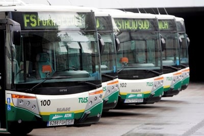
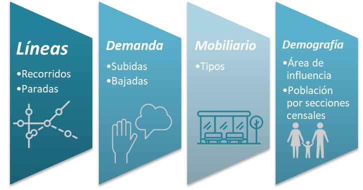
Transports Urbans de Sabadell has an increasing volume of data on the 14 million annual passengers, the use of the 360 bus stops, the demand of the inhabitants by zones, the geolocation of the furniture and the real-time location of the buses. The implementation of the GIS system has achieved to organize on the map in all this information in a unified way and adopt a common language to better understand the operation of public transport based on three axes: demand, mobility and demography.

The system provides many possibilities in decision support, beyond counting lists, and allows you to obtain visual summary tables that help you interpret the data.

• Query and filter the offer of transport: Lines, tours and stops.

• Interactive query the demand, from a stop, check where the passengers come from or where they are.

• Include demographic data on the map, with indicators that help decision-making.


Sabadell is a city of 210,000 inhabitants, with a network of 15 public transport lines, 360 stops, 65 buses, with 14 million passengers, operated by Transports Urbans de Sabadell.
TUS

Categories

Congress and conferences
Transport and infrastructure
NexusTeam
GIS Solutions for City Councils
Smart Mobility
City Councils
Awards
Spatial intelligence
Geolocation
Article
APPS

Related news

pisos
Tue, 02/20/2018 - 00:00
Maps with 3D buildings with apartments and houses on the real estate portal Pisos.com
ematsa
Fri, 02/09/2018 - 00:00
A Touch screen application to inform of field-work water samples
TUS
Mon, 01/15/2018 - 00:00
GIS system of mobility and public transportation of Sabadell
aparkb
Fri, 01/05/2018 - 00:00
Nexus Geographics chosen by B:SM for the development and implementation of the "Where to park for minutes" platform
 
CONTACT
  • Barcelona Office
    Aragó 264 4, 08007 Barcelona
  • Girona Office
    Joaquim Botet Sisó 6, 17003 Girona
  • Madrid Office
    Paseo de la Habana 9-11, 28036 Madrid
  • +34 93 0172728
    [email protected]
  • TwitterYoutubeLinkedin Instagram
  • energia renovableaeonorENSISOPymeInnovadora
SECTORS
  • City councils
  • Public authorities
  • Mobility and sustainability
  • Service networks
  • Companies and businesses
  • Logistics
NEXUS
  • News
  • Work with us
  • Cercalia
  • enMapa
  • reCitty
  • Contact
OTHERS
  • BusManager
  • Routing Reparto
logo soclogo generalitatLogo eulogo next gen
  • Quality and safety policy
  • Cookies policy
  • Privacity policy
  • Social media policy
  • Legal advice
  • Home
  • 25 years
  • News
  • Sectors
    • City councils
    • Public authorities
    • Mobility and sustainability
    • Service networks
    • Companies and businesses
    • Logistics
  • Tools
    • Cercalia
    • enMapa
    • Recitty
    • Custom solutions
  • Contact